New York cloudburst flooding
Flooding in a moderate cloudburst (2.13 in/hr) with 2050 sea level rise. Source: NYC Department of Environmental Protection, NYC Stormwater Flood Maps, NYC Open Data.
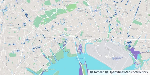
A heavy cloudburst, 2050
- Nuisance flooding, 4 in – 1 ft
- Deep flooding, 1 ft and deeper
- High tides by 2050
Where the Data Comes From
- Publisher
- NYC Department of Environmental Protection
- Dataset
- NYC Stormwater Flood Maps
- Licence
- NYC Open Data Law
- Credit
- Source: NYC Department of Environmental Protection, NYC Stormwater Flood Maps (moderate flood with 2050 sea level rise), NYC Open Data.
Built from the publisher’s official data, tidied up so it reads clearly and loads fast. Nothing is made up and nothing is moved.
What’s Inside
- 1 layer: A heavy cloudburst, 2050
- 3 live charts beside the map
- Already styled and ready to share
- It opens as your own copy. Swap in your data whenever you like.