See what a street is already made of.

See every café, bar and restaurant in a district and get a feel for each street. Find the busy corners, and the gaps.

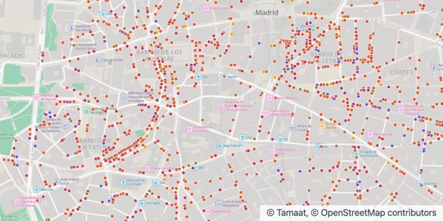
Where central Madrid eats and drinks

Food and drink

  • Restaurants
  • Tapas bars & taverns
  • Cafés & tea rooms
  • Late-night bars & live music
  • Fast food

What retail teams do with Tamaat

  • Get to know the neighbourhood

    See every place by type and spot what each street has plenty of, and what it lacks.

  • Compare trade areas

    Put income and population next to your locations and compare one area with another.

  • Keep your locations up to date

    Refresh your locations from a file, a database or cloud storage, without redoing the map.

Stories From the Gallery

Where central Madrid eats and drinks

Where central Madrid eats and drinks

Food and drink venues with a street door in the Centro district. Source: Ayuntamiento de Madrid, Censo de locales y actividades (October 2026), CC BY 4.0.

Source: Ayuntamiento de Madrid, Censo de locales y actividades (October 2026), CC BY 4.0.

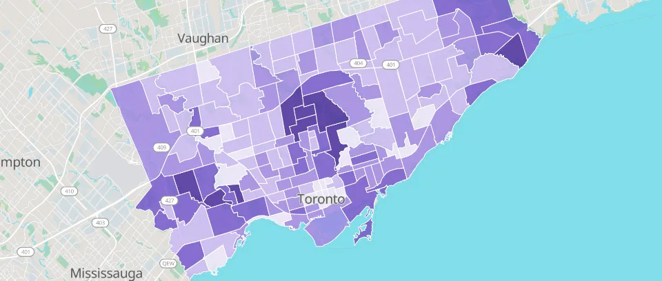
Toronto household income
Also in Cities and Public Sector

Toronto household income

Median household income in Toronto’s 158 neighbourhoods, from the 2021 Census. Sources: City of Toronto Open Data, Open Government Licence – Toronto; Statistics Canada, Statistics Canada Open Licence.

Sources: City of Toronto Open Data, Open Government Licence – Toronto; Statistics Canada, Statistics Canada Open Licence.

Guides and Answers

Start from a working map.

Open an example in your workspace, or let us show you Tamaat on your own data.